07-08-2002 (Wednesday )
We are sitting in the train to Bergen. Everything went chop chop. On inquiring about buses and trains we were told that there is a night train to Bergen which stops at Finse at 4h12 in the morning. The price also didn't look too bad (just over 600 Kr including the fare to the main station in Oslo), so quick decision: lets jump onto the train. First the train to Oslo and after sitting around for two hours onto the train to Bergen.
A word about the trains. They can be compared to the best in the world, i.e. Switzerland. Very smooth, very comfortable, very punctual (let's see).
At the station I got hungry again, obviously the airline food wasn't very filling. I went for one of the specials, a sort of hot dog and a coke thrown in for a mere 39 Kr.
We duly got onto our train to Finse, it left on the second of 23H11. The scenery is most likely stunning, but we couldn't see it, it was dark. That is why in Finse we decided to take a day train back to Oslo. But we are not at that point yet.
08-08-2002 (Thursday)
The train stopped in Finse early in the morning at 4H20. The sun was not out yet, but we had enough light to see where we were going. An interesting phenomena observed during the night was to see the partly lit sky at the point where the sun was beyond the horizon. I watched it moving from west (sunset) through south to east (sunrise).
We didn't walk far, just enough to get away from the center, tent was put up close to rail, it was the only semi-flat spot we could find. Once inside we were gone until about 10H00.
 The next phase was planning and getting supplies. There was a shop next to the station. Big problem, they had no Rødspirit, which I needed for my cooker. Jim was moaning, there was nothing we could do. She then offered me a half full bottle of something that burns. It turned out to be benzene. Not the best stuff for my cooker but it has to do. The stuff doesn't burn very well and is very smoky, there was no more making coffee in the tent. We also got a hiking map, this helped us to make a plan.
At the station we got ourselves a return ticket from Usteoset, a station further down the track towards Oslo.
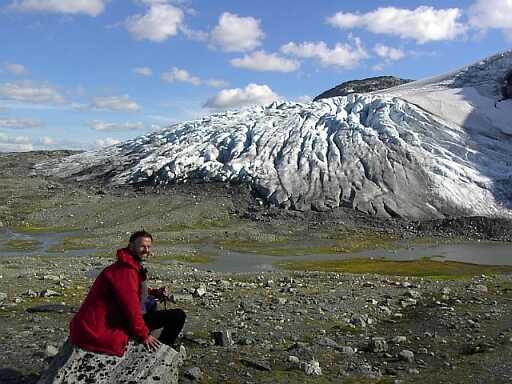
Our first aim out on the hike was to see a glacier, for that purpose we went up the mountain and put up tent at a likely looking spot. And then without luggage we got to the glacier and Jim actually onto it. But first there was to be a river crossing. We could have avoided it, but felt it was good sportmanship to do and we also didn't know that the sign on the path that pointed to something called BRU actually meant bridge. The river was wide, fortunately not deep but as usual ice cold. My feet were falling off when I got to the other side.
Of course Jim had to climb onto the glacier but was off like a shot when there was that thumb of falling ice. We couldn't see where it had fallen, but we had visions of the whole lot coming down in one shot. We cleared the area and went back to our tent for a good nights sleep.
09-08-2002 (Friday)
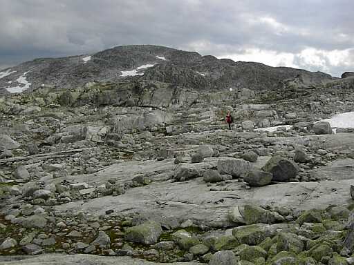 Cross country we went to the bridge that crosses the raging torrent of water coming from the glacier. Onto the path we could now proceed at a rapid rate in a southerly direction. It was a bit up and down, fortunately not much.
At some lake without a name (it must be impossible to give every lake a name in Norway) in the Helvetes area we put our tent down, having walked only 10 km.
On the way we met interesting people. There was this guy from Aberdene who had walked from Stavanger and will stop in Finse. I measured this as an approximately 250km walk. And then there was this Norwegian woman who spent 3 years in Botswana as a development aid worker. We had lots to discuss and notes to compare.
The countryside we walked through is very rocky, it looks like the devil has been here throwing around rocks, big and small all over. Vegetation is not very luxurious as we had seen in Tromsø. The blueberries still need a few days to ripen and so far we have seen no mushrooms.
10-08-2002 (Saturday)
 Same story again, just walked. But stopped for a long time to look at a magnificent glacier hanging over the lake.
We hardly met anybody and only stopped to talk to one young couple who were going to do our two day hike in one day.
The river we had been following has turned into something mighty. We eventually have to cross it, but there is no bridge shown on our map. We had to wonder how do we cross this?
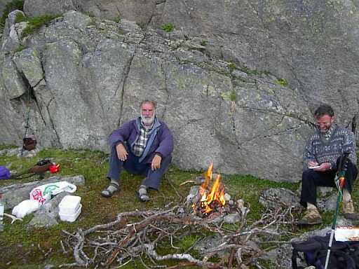
We camped before the crossing and made a fire. There was a nice spot that had been occupied before and our predecessors has left us some wood. To make sure of a nice fire we collected some more.
11-08-2002 (Sunday)
Walk, walk, rain, rain, rain suit on, rain suit off. That is how the day went. Nothing much to report, we covered 11.2 km and are camped at the lake Halnetj.
12-08-2002 (Monday)
We were closer to the up and over than we thought and in no time were we on our way down to Krækkjahytta. You may wonder why didn't I use the GPS to determine our position? I would have known then how close we were to the up and over. Well, the map we bought had no latitude and longitude, just some Norwegian grid to which I had no reference. Will all producers of hiking map in future use the WGS84 datum please. At Krækkjahytta they have a little shop and I bought some biscuit and a cold drink, it probably set me back an astronomical sum of money. But I had given up thinking in these terms.
We had to study the map on the wall very carefully because we were getting to the edge of our map and I didn't want to come to any surprises, like a Y-fork and no idea where to go.
It started raining again and the path was wet and muddy. I slipped and fell once more and broke my stick. I thought that this would be the end of the stick, but after some consideration and the use of a rock as a hammer I had the two pieces together again.
Lunch was under an overhanging rock and under my space blanket. Very cosy and warm. We finally stopped after we left the lake behind us. It was a struggle to find a flat spot.
13-08-2002 (Tuesday)
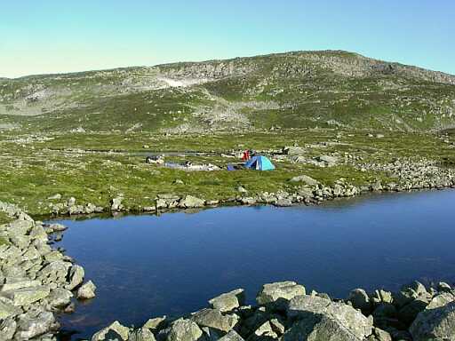 What a difference a little sun makes. We woke up to a totally blue sky and sun. Immediately we spread our things out into the sun for drying. And there was no hurry to get going.
From the campsite it was up for a bit until we looked down into the valley and could see the shopping center of Haugastøl. There was no stopping, except for some blueberries now and than. The vegetation became more luscious as we descended into the valley.
I had run out of bread in the morning, thus the shop was very welcome. Apart from the bread for 25 Kr I had some Sursild (a sort of pickled fish), yogurt and a cool drink.
And here we found a telephone, it didn't look like the normal ones but it invited to make a call. It ate up my 30 Krona in seconds before I could say very much. The same happened to Jim. He still thought my money disappeared so quickly because I had phoned Eleni on the cell phone.
Coffee was cheap in the Kafe, only 15 Kr for a big cup, so we had one each. And after that it was lunch. This we had on the lake shore. I used the opportunity to wash (or rather rinse) a few essentials in the lake.
Essentially the hike was over, but we still had a few days. Ustaoset, the railway station we will depart from was only 10km by road. We decided to the take the inland route, that is back into the maintains and via a long way around to Ustaoset. We didn't have a good map, only what we found at the last information center. It had to do.
 And, of course, we got it wrong. Landed on the wrong path, going in the wrong direction. We had missed the turnoff somewhere. But not a problem, we have a spare day, and tomorrow we can go cross country to pick up the right path. That way we would not loose any of the height we had gained. I was not looking forward to this because it is not easy walking off the path. Vegetation is mostly grass and low shrub, no trees.
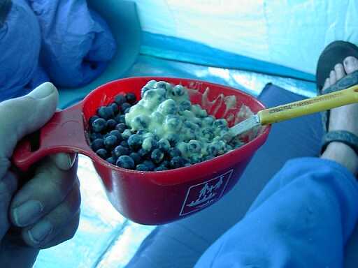
For tonight we had a feast on mushrooms (the redcaps are out again) and for pudding I made some custard and had this with the blueberries I had collected during the day.
14-08-2002 (Wednesday)
So off we went across country to pick up the other trail. It was a stuff-up, we didn't find it. At one stage we thought we had and used it, but it turned out to be some other path not on our map. For a while it did go in the general right direction.
The country site was lovely with lots of lakes full of crystal clear water. At one of them we stopped to have lunch.
The spot we selected had been used by other people and contained a few fire places. We lit a fire to fry our mushrooms. Jim had a concern that his gas was running low.
 A highlight of the lunch was to observe a Stoic, that is a type of Mongoose. It was snooping around our lunch spot, being interested in what we were doing when suddenly it charged off and caught a mouse that had been scurrying through the grass. Triumphantly it left the field carrying the prey between its jaws.
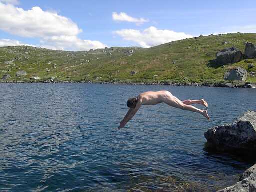
Another high lite was Jim taking a jump into the lake. I made a weak attempt to go in but was repelled by the coldness of the water.
Pushing on over the hills, past little lakes we eventually got to a ridge that allowed us a view over the lake to Embretstølen, that is where the trail is supposed to go. It was no use picking it up now, mainly because there was this lake between us and the trail. If we carry on on our side of the lake we will eventually cross over and pick up the path.
But first we bedded down to stay the night. And we made a fire again.
15-08-2002 (Thursday)
The third day of sunshine. It's great! Packing our things we made our way down the mountain to the lake, following it until we came to the end of it where we could cross. This immediately put us onto a road. The map showed that we cross the road and take a more scenic route into Usteoset, we couldn't find any such path, so we stuck t the road and marched straight down the mountain.
The first thing we hit was the supermarket where I stocked up again for the last time. With our coke and yogurt we went down to the lake shore and had our lunch. And after that we went out to find a place to sleep. On the way past the shop I bought an 'Aftenpost' for 14 Kr, just to see what sort of news we could gather from a Norwegian newspaper. The place we selected was the point of a peninsula just opposite the station. It was a hot day with hardly a cloud in the sky, we actually got sun burned sitting around the in the afternoon without a tree to shelter us. The hot weather invited for a swim. The water was still fairly cold, but it had to be done, once in it wasn't too bad.
next page
return to Norway page
return to home page
 The next phase was planning and getting supplies. There was a shop next to the station. Big problem, they had no Rødspirit, which I needed for my cooker. Jim was moaning, there was nothing we could do. She then offered me a half full bottle of something that burns. It turned out to be benzene. Not the best stuff for my cooker but it has to do. The stuff doesn't burn very well and is very smoky, there was no more making coffee in the tent. We also got a hiking map, this helped us to make a plan.
 Cross country we went to the bridge that crosses the raging torrent of water coming from the glacier. Onto the path we could now proceed at a rapid rate in a southerly direction. It was a bit up and down, fortunately not much.
 Same story again, just walked. But stopped for a long time to look at a magnificent glacier hanging over the lake.
 What a difference a little sun makes. We woke up to a totally blue sky and sun. Immediately we spread our things out into the sun for drying. And there was no hurry to get going.
 And, of course, we got it wrong. Landed on the wrong path, going in the wrong direction. We had missed the turnoff somewhere. But not a problem, we have a spare day, and tomorrow we can go cross country to pick up the right path. That way we would not loose any of the height we had gained. I was not looking forward to this because it is not easy walking off the path. Vegetation is mostly grass and low shrub, no trees.
 A highlight of the lunch was to observe a Stoic, that is a type of Mongoose. It was snooping around our lunch spot, being interested in what we were doing when suddenly it charged off and caught a mouse that had been scurrying through the grass. Triumphantly it left the field carrying the prey between its jaws.