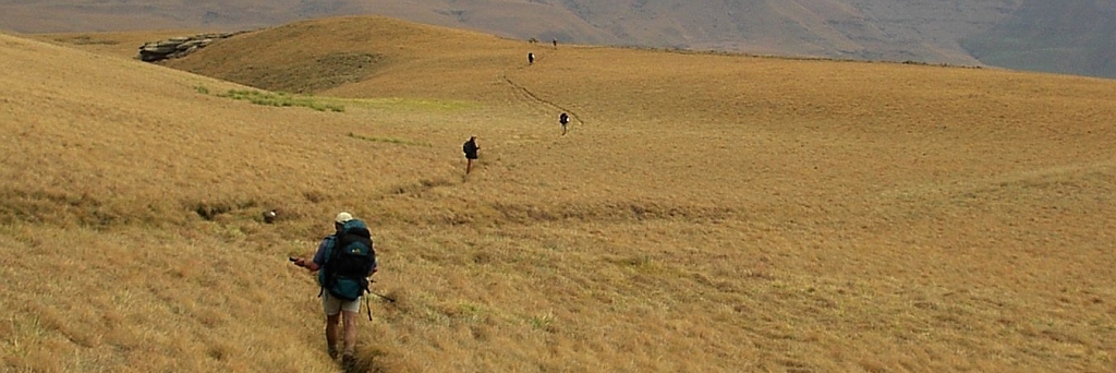
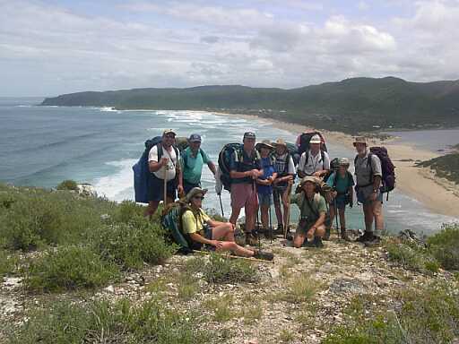
 Probably South Africa's premier hiking trail. Getting a booking is not easy and has to be done month, if not years, in advance. Tanya and Allen managed to get such a booking and 12 of us went down. Who were they? Tanya, Allen, Antonio (formaly known as Tony N.), Tony R, Hester-Louise, Janine, Eric, Christopher, Frans, Piet (newcomer), Jörg and I.
Because it's so far to drive I decided to treat Christopher to a ride on the plane, Jörg followed suit. Allen and Tanya collected us from the airport and put us up in their rented house in Sedgefield. It all worked out very well.
The next morning we went off to the Stormsriver mouth, the starting point of the hike. Here we met with all the other participants and the hike could start. The first day is easy, to Ngubu hut it is only 4.8km. Just the walking is not easy, its very rocky and its up and down over big and small rocks. A long halt was called at the waterfall, so that the hardy participants could go for a swimm in the cold water.
From here we had to climb about 140m before we were let down to the huts.
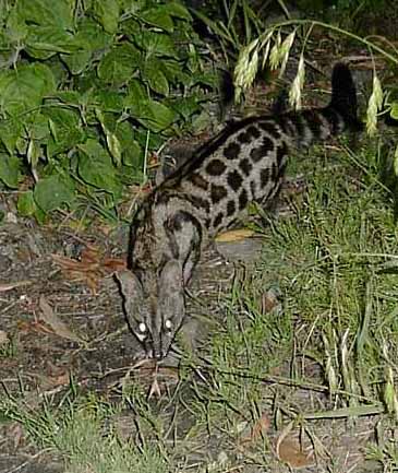
One of the excitements of the evening was to spot a Large Spotted Genet (Genetta tigrina). It had come to check for left overs. I managed to get it into memory by holding the camera in the right direction and pushing the button at the right moment.
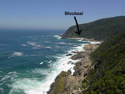
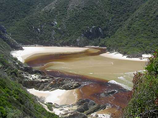
The 2nd day was also fairly short, only 7.9km. It has to be so short because of the lovely swimming spots along the route. There is a lovely tidal pool before Skilderkrans. Everybody was in. Skilderkrans itself is a piece of rock sticking out into the sea. Access to it is via a narrow natural ridge which has to be negotiated with care, falling off can have dire consequences. The view from the top of Skilderkrans is tremendous in both directions. And then came the Bloubaai, which is one of the few proper beaches on the trail. We droped the rucksacks up on the path and made our way down to have a swim and lunch.
 Oakhurst is the next hut, a hike of only 7.7km. But this one was possibly the most difficult section. There are a number of ups and downs, the highest one going to 200m. In addition it was hot, stinking hot. Such a relief to come down to the Lottering river and to dive into the water. This is just before the huts and we had a looong rest.
The stretch to Andrè had me worried, it was 13.8km. If it is as hot again we will have a problem. But morning greeted us with an overcast sky and that is the way it stayed. At that rate the 10km to the Bloukrans river crossing were done in no time and by 12h30 we settled down on the banks of the river to await the low tide so that we can cross.
Problem, the lower tide didn't change the level by much, it was neap tide and thus not much difference between high and low tide. The waves were still coming in and the swim was going to be fairly long. In addition it became somewhat cool and started to drizzle. At that rate not many people fellt inclined to jump into the river to cross. A majority decision was taken to abandon and to take the escape route.
 A steep climb took us out of the gorge onto the plateau. Following a forest road from there to the bridge was easy. It started to rain seriously. Following the N2 over the bridge and up a bit to a bridge over the N2 was quickly done. And than we got lost, because we had no clear directions and the map also didn't help and also remember men don't ask for directions. But blundering along we followed the forest road until we got to a place where we just couldn't decide where to go. Voices started to raise themselves: 'why don't we phone?' Well, yes, this is the age of the cell phone. Just a bit difficult in the rain, but Allen managed. Contact was made, yes we are on the wrong path, go back to the N2 and follow a different road, and we will send a bakkie. So we walked through the driving rain with me getting very concerned about Christopher who was slowing down considerably. The bakkie with a ranger behind the wheel arrived in due course and we all climbed on. It was a hair raising ride (for those on the back, not for me, I was inside), but saved us about 3km of walking. We were dropped just above the huts, all we had to do was to climb down the 100m or so. And this in good time, it started to get dark.
No fire was made this evening, because it kept on raining and the two groups just withdrew into their 6 bed huts and stayed there for the night. It was very comfortable.
A steep climb took us from the sea to the 100m contour and that is where we stayed, mostly, until we had to descent onto the beach at Nature's Valley. And that was the end of the hike. Our lifts arived very soon and we returned to Sedgefield.
 Other activities before our departure were an evening stroll and dinner at the Knysna waterfront, a walk through the Knysna forest and I also spent some time with Carl Rietbroek, a caver from SASA who retired down to Sedgefield about two years ago. And he made me envious about their quality retirement, living in a beautifull area, full of activities, hiking, climbing and their newest hobby kayaking, as well as studying geology at the local university of the third age. It has given me something to think about my own retirement.